Placeholder
Ownership & title panel
Crop of the KYE location / title page showing owner and parcel details.
16/10
01
Ownership & title
Confirm who holds the land, how it is described, and the title context you need before you go further.
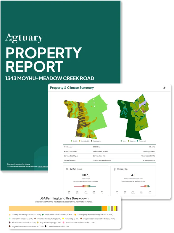
Agtuary Know Your Environment (KYE) reports pull ownership, sales, soils, climate, fire and production into one Australian rural due diligence pack - so agents, valuers and lenders stop assembling the same evidence from ten systems.
Trusted by rural teams at








Agtuary KYE pulls ownership, sales, soils, climate, fire and production into one report - from the same mapped layers every time. Generate it when the property lands and take a complete land story into the deal straight away.
Generate a KYE report in minutes - without spending days pulling title extracts, rainfall charts, soil maps and fire history from separate systems.
Ownership, sales, soils, climate, fire and production arrive together - ready to attach to a listing presentation, valuation or credit memo.
Walk into a vendor meeting, buyer briefing or credit committee with the land story already assembled - the same structure, every property.
Each report is generated from the same mapped layers, so every property in a portfolio has the same structure. Open a parcel. Download the file.
Placeholder
Ownership & title panel
Crop of the KYE location / title page showing owner and parcel details.
16/10
Confirm who holds the land, how it is described, and the title context you need before you go further.
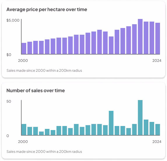
See how the property and nearby land have traded, without leaving the due diligence file.
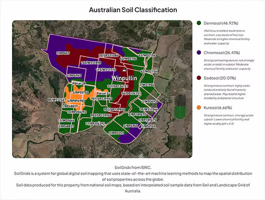
Classify soils, slope and elevation so production potential is visible before anyone walks the paddock.
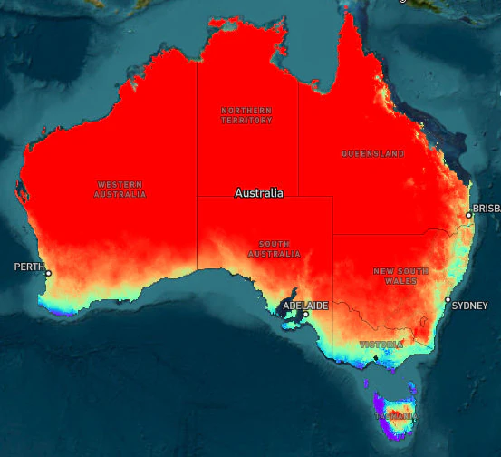
Seasonal and long-term rainfall, plus climate risk and change indicators, sit next to the property - not in a separate climate portal.
Placeholder
Fire risk & history map
Tight crop of fire history / fire risk for a single rural property.
16/10
Show fire history and current risk on the same map the credit memo or buyer pack already uses.
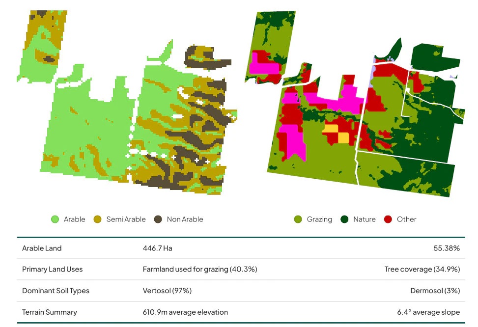
Land use, arability, detected buildings and production indicators - the questions buyers and lenders actually ask.
KYE is built for people who do not have a GIS team. If you can find a property, you can produce the pack.
Search by address, title or map. Agtuary matches the parcel so you are working from the operating property, not a guess.
Placeholder
Property search screenshot
Map search / parcel selected on a rural holding.
16/10
The report pulls ownership, sales, soils, climate, fire, buildings and production from the same mapped layers.
Attach it to a listing presentation, a valuation, or a credit memo. Same structure, every time.
Product walkthrough
Placeholder
KYE product demo video
Embed a 60–90 second walkthrough of generating and paging through a KYE report.
16/9
Same pack. Different outcome, depending on who puts it in front of the client.
Enter your work email and we will send a sample Know Your Environment report covering property, land, climate and environmental data.
A KYE or CMA report is $50 on the Free plan. Professional is $199 a month or $1,999 a year for unlimited reports, the inspection app, and the rest of the platform.
Compare plans →KYE is a property-level due diligence pack: location and title context, sales history, detected buildings, soils, terrain, land cover, rainfall, fire, climate history, and production indicators.
Agtuary generates each report from the same mapped data layers, giving every property in a portfolio a consistent structure.
Use it before acquisition, as an attachment to a credit memo, or as buyer education alongside a marketing campaign.
“In Australia, our Agribusiness team conducted a comprehensive review of all agriculture property specific platforms to map, measure, monitor and plan for our client's natural capital future. Agtuary was identified as our preferred partner to meet these needs of our Colliers Agribusiness clients.”
Review ownership, title, sales history, soils, climate, fire, buildings and production indicators in a Know Your Environment report.